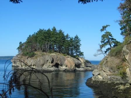
The idyllic San Juan Islands are located in the northern reaches of Puget Sound, some 80 miles north of Seattle in the northwestern-most corner of the state of Washington. Their natural beauty, equitable climate, and relaxed lifestyle make them an increasingly popular place with vacationers as well as retirees. Over the years, the San Juans have been included in various lists of America’s most desirable places to live. There are approximately 172 islands in the group, depending on how you count them. The four largest and most populated are accessible by Washington State Ferries out of nearby Anacortes. These are San Juan, Orcas, Lopez, and Shaw Islands. Waldron, Stuart, Blakely, and Decatur Islands also have significant populations although they are only accessible by smaller boats, or by air. A few of the smallest islands are owned and lived on by individual families.
The islands together comprise San Juan County, the smallest in the state by area, and 8th smallest by population. The county seat is at Friday Harbor, on San Juan Island. It is also the islands’ largest and only incorporated town.
The earliest inhabitants were Native Americans and First Nations peoples of the Central Coast Salish Tribes, mostly of the Lummi Nation. Ancestral Lummi peoples used the islands as part of their yearly transient migratory patterns which also included Point Roberts, the lower lands of the mainland, and other outer islands. Archaeological evidence suggests that the island supported hunting and gathering between 6,000 and 8,000 years ago. British and Spanish explorers discovered the islands in the 18th century but settlement by white settlers didn’t begin until the 1850s.
First to settle here were a few British trappers and sheepherders, and some Americans returning, disappointed, from searching for gold in Canada’s Caribou country. Conflicts between the British and the Americans came to a head in the so-called “Pig War” of 1859 which disputed possession of the San Juan Islands. The dispute arose from the vague language in the treaty of 1818 which stated that the boundary would extend westward along the 49th parallel. This became a problem after the Oregon treaty in 1846 which did not specify whether the border would divide the Haro straight, preferred by the Americans, or the Rosario Straight, preferred by the British. An American settler on San Juan, Lyman Cutlar, shot and killed a British-owned hog that persisted in invading the American’s potato patch. With both nations claiming jurisdiction of the area, U.S. troops were sent to confront British authorities when they attempted to arrest Cutlar. British warships then appeared off the San Juan coast and a shooting war appeared imminent. Fortunately, cool heads prevailed and the two governments agreed to a joint occupation of the San Juans until a boundary could be agreed to.
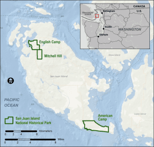
The Americans made camp on the south peninsula of the island at today’s American Camp, while the British made their camp in the more temperate and less harsh northern shore at today’s English Camp. Finally, the question was submitted for arbitration by Kaiser William I of Germany who decided in 1872, after extensive mapping and analysis of contested channels, that the Americans had the stronger claim to the islands. This ended the last territorial conflict ever between the United States and Great Britain. The war had lasted 13 years and proved to radically reshape the islands.
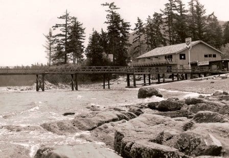
The waters surrounding the San Juans remain open to navigation and are extremely popular with boaters from both America and Canada. Also because of their strategic location, they have, in times past, proven attractive to smugglers and rum-runners as routes for the illicit transporting of everything from undocumented immigrants to commodities like drugs, wool, and liquor. On the whole, though, the islands have historically been populated by farmers, fishermen, seafarers, and other community-minded individuals.
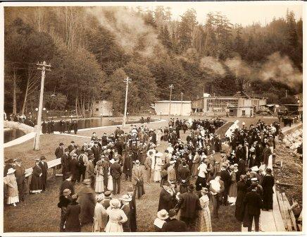
The year after the Pig War ended, San Juan County was officially created. In the years following, colonization and settling by Americans resumed but at a faster pace than when the territory was disputed. Realizing what the British Hudsons Bay Company had learned in the 1850s, and the natives long before that, the value of the salmon runs off the shores of the islands, large fishing industries became prevalent in the San Juans and throughout the Salish Sea. The extensive logging industries that had developed in the San Juans in the following decades came to a peak when Andrew Newhall, who operated the largest sawmill in the area out of Cascade Bay, sold to Robert Moran, a former mayor of Seattle and prominent shipbuilder. By the end of his logging enterprise, Newhall had supplied 2.5 million cords to the lime kilns of Roche Harbor, which had become the largest lime works in the West.
As the fishing, logging, and lime industries began to wind down due to continued expansion and settlement of the west, leading to more competition in the commanding heights and driving down prices, homesteaders, small family farms, and orchard farmers hosted a growing tourist population that came to the islands for their serene views and peaceful atmosphere.
The San Juans are actually the remaining mountain-tops of a receding continent much older than the American mainland. The islands are generally quite hilly, the tallest mountain being Mount Constitution at almost exactly a half-mile elevation, with some flat areas and valleys, often quite fertile, in between. The coastlines are a mixed bag of sandy and rocky beaches, shallow and deep harbors, placid and reef-studded bays. Gnarled, ochre-colored madrona trees grace much of the shorelines while evergreen fir and pine forests cover large inland areas.
The islands get less rainfall than nearby Seattle because of protective shadowing from U.S. and Canadian mountain ranges. Summertime high temperatures are around 70 degrees Fahrenheit while average wintertime lows are in the high thirties and low forties. Snow is infrequent in winter except for the higher elevations, but the islands are subject to high winds at times– those from the northeast sometimes bringing brief periods of freezing and arctic-like windchills.
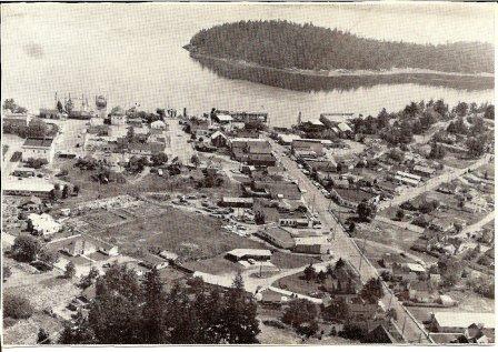
San Juan Island – San Juan is the busiest island with a number of small businesses operating there, county government being the biggest employer, and tourism and growth the major industries. The waterfront is colorful and a delight to visit especially on nice days, with a myriad of pleasure craft coming and going, along with ferries, fishing boats, yachts, and every other sort of craft. The town has several good stores and lots of gift and souvenir shops, banks, drugstores, gas stations, and so on. A unique Whale Museum in town will tell you everything you want to know about these fascinating animals, especially the “killer whales,” or orcas, which inhabit local waters and were made famous in movies like the locally filmed “Free Willy.” The Friday Harbor Marine Laboratories on the edge of town are a world-famous research center and a mecca for oceanography students- -unfortunately, they no longer do public tours. Besides Friday Harbor, the village and resort of Roche Harbor are worth a visit. Roche Harbor was a typical company town earlier in this century, where lime production was a major industry and revenue source. The whole town and, some say, the souls of the workers were owned by boss John S. McMillin. The historic Hotel de Haro, which once hosted President Teddy Roosevelt among other VIPs, and the remarkable McMillin family mausoleum are among a number of places worth inspecting.
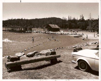
Orcas Island – Orcas is slightly larger but less populous than San Juan. Shaped like a pair of saddlebags, it is almost bisected by fjord-like East Sound (two words), at the northern end of which is located the village of Eastsound (one word), the second largest town in the county.
Eastsound has a number of stores, inns, and excellent restaurants in addition to gift and souvenir shops, gas stations, and other businesses. There are other, smaller settlements at Orcas (where the ferry lands), West Sound, Deer Harbor, Olga, and Doe Bay, each different and worth leisurely sightseeing. At Olga, there is an attractive and popular cafe and store (the rustic building is a former strawberry barreling plant) where local artists hang out and sell their work.
Half-mile-high Mount Constitution is a prime attraction. The easy drive to the top (except in the worst winter weather when park rangers close the road) rewards one with a spectacular 360-degree marine view said to be one of the finest anywhere in the world. The mountain is part of Moran State Park, which also offers camping, swimming, fishing, and hiking par excellence in its nearly 5,000 acres of woodland peace.
Lopez – Lopez is the first place the ferry lands after leaving Anacortes. The island is relatively flat compared to the other islands, which makes it especially popular with bicyclists. The main village is Lopez, halfway down the west coast, where you will find stores, an inn, and other services. It is the one island that still has some profitable working farms and a low enough traffic volume that drivers still wave to each other as they pass. Lopez has good beaches and campgrounds, including 80-acre Odlin Park at the island’s north end, and Spencer Spit State Park to the southwest. Camp Nor’wester offers boys and girls all the usual summer activities of swimming, boating, and hiking as well as crafts and Northwest-oriented Indian lore activities.
Shaw – Shaw is not a large island, and is unique in having virtually no commercial or tourist-oriented facilities other than two smallish parks, most of the island is privately owned by people who like their slow-paced privacy. Roads are mostly inland and afford little access to or even views of the shoreline. One major exception to these roads is Blind Bay road which connects the ferry terminal to the rest of the island along a one-mile shoreline drive.
For more information…
Parts of this brief introduction to the San Juans is courtesy of David Richardson, author of two best-selling books:
- Magic Islands: A Treasure-Trove of San Juan Islands Lore
- Pig War Islands: The San Juans of Northwest Washington
This article is curated by San Juan Web Management.
We strive to provide interesting and accurate information about the place we live.
If you have found something you believe to be inaccurate or out of date, please let us know.
We would also love to answer questions about the islands. Feel free to contact us.
